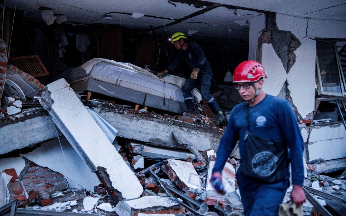
Colombia faces one of its most severe natural disasters in recent years following a magnitude 7.4 earthquake that struck western regions on Monday, leaving at least 132 people dead and injuring more than 570 others. The Colombian government released updated casualty figures confirming the scale of the catastrophe, which has prompted authorities to declare a national state of disaster and mobilise emergency resources across affected zones.
The earthquake's impact has been geographically widespread, with 32 municipalities reporting significant damage across the country. However, the destruction has concentrated heavily in five key departmental capitals that now operate under red alert status. The cities of Pereira, Cali, Quibdo, Manizales and Armenia face the most critical situations, requiring urgent humanitarian assistance and coordinated rescue efforts. This geographic distribution means that Colombia's disaster response must balance resources across multiple regions rather than focus on a single epicentre.
Among the hardest-hit areas, Pereira has suffered the most catastrophic losses, accounting for 60 of the total deaths recorded so far. Cali, Colombia's third-largest city and major economic centre, has reported 15 fatalities, while Quibdo and Manizales recorded eight and four deaths respectively. These figures underscore the uneven impact of seismic events, which depends on factors including population density, building construction standards and distance from the epicentre. The variation in casualties across cities provides critical information for understanding infrastructure vulnerability in Colombia's western regions.
Structural damage has been extensive, with rescue workers confirming that 86 buildings have either collapsed or sustained severe damage requiring demolition. This scale of infrastructure destruction will likely complicate both the immediate rescue phase and longer-term reconstruction efforts. Additionally, operational disruptions extend beyond ground-level damage. Seven airports have suspended operations due to earthquake-related harm to facilities and infrastructure, disrupting transportation networks and complicating the delivery of emergency supplies to affected communities. These airport closures particularly affect international aid coordination and domestic evacuation capabilities.
President Abelardo de la Espriella's declaration of national disaster status represents a crucial administrative step that enables the Colombian government to mobilise federal resources, bypass certain bureaucratic procedures and access emergency funding mechanisms. Such declarations typically unlock rapid deployment of military assets, emergency services and humanitarian support that might otherwise be restricted by normal governmental processes. This status also facilitates coordination between regional and national authorities, allowing for more efficient resource allocation across the five red alert zones.
The precise details of the earthquake's occurrence provide essential context for understanding its severity. The Colombian Geological Service recorded the event at 7.34 am local time, striking near San Jose del Palmar in Choco department at a depth of 96 kilometres. The relatively deep epicentre, compared to shallow earthquakes that typically cause greater surface damage, suggests that the magnitude 7.4 rating reflects considerable subterranean energy release. This depth characteristic is relevant to seismic experts assessing whether significant aftershocks should be anticipated, as deeper earthquakes sometimes produce different aftershock patterns than shallower events.
International actors have begun coordinating response efforts. China's embassy in Colombia activated emergency protocols immediately following the earthquake and has been systematically checking the welfare of Chinese nationals throughout the country. While the embassy has reported no casualties among Chinese citizens to date, this represents preliminary assessment data that may change as full accounting occurs in the days ahead. The swift mobilisation of embassy resources demonstrates how major seismic events trigger international disaster response mechanisms even in countries where foreign national presence may be limited.
For Malaysia and other Southeast Asian nations, the Colombian earthquake serves as a sobering reminder of seismic vulnerabilities affecting the wider Pacific Ring of Fire. While Colombia sits on different tectonic systems than Malaysia, the casualty scale and infrastructure damage patterns offer valuable lessons for regional disaster preparedness. The rapid government declaration of national disaster status and emergency response activation reflect best practices that could inform Malaysian contingency planning. Additionally, the significant disruption to airport operations highlights the cascading effects earthquakes can trigger on critical infrastructure beyond immediate impact zones.
The coordination challenges evident in Colombia's response—managing five red alert zones simultaneously while processing 132 deaths across 32 affected municipalities—mirror scenarios that regional disaster management agencies across Southeast Asia consider in simulation exercises. The decision to prioritise resource distribution across multiple severely affected areas rather than concentrate on a single epicentre reflects the complex triage decisions that major earthquake responses inevitably demand. Malaysia's own disaster management frameworks, particularly relevant given the country's position near seismic zones and experience with cross-border humanitarian coordination, can benefit from observing how Colombian authorities balance immediate life-saving operations with longer-term reconstruction planning during the critical first 72 hours following impact.

