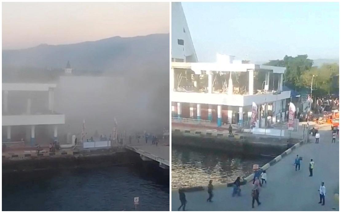
Eastern Indonesia faced a major natural disaster on Saturday when a magnitude 7.7 earthquake struck off the coast of Flores Island, leaving at least 20 people dead and triggering widespread damage across the region. Emergency officials reported that six others sustained injuries while two residents remained trapped beneath collapsed structures, underlining the severity of the disaster affecting communities in one of the country's most geologically active zones.
The earthquake's epicentre was located near the town of Mbay in Nagekeo Regency, triggering not only the initial powerful tremor but also numerous strong aftershocks that compounded the danger for residents and hampered rescue efforts. Initial tsunami warnings were eventually lifted by Indonesia's Meteorology, Climatology and Geophysics Agency, though authorities cautioned residents about the ongoing risk of further seismic activity. This region sits along the Pacific Ring of Fire, making frequent earthquakes a persistent threat to the area's population and infrastructure.
Governor Melki Laka Lena of East Nusa Tenggara province provided preliminary assessments at a press conference in Kupang, describing how multiple buildings and residential structures had been destroyed or severely compromised. Beyond the collapsed buildings, several critical transportation routes became impassable due to landslides triggered by ground movement, isolating some communities and complicating evacuation and relief operations. The full scope of destruction remained unclear as authorities continued compiling comprehensive damage assessments across the affected areas.
Social media footage revealed the catastrophic nature of the impact, with videos showing structures reduced to rubble and dust clouds rising into the air. Panic-stricken residents could be seen fleeing into streets and open areas to escape collapsing buildings, illustrating the frightening seconds residents experienced as the ground shook beneath them. The chaotic scenes underscored how sudden and violent such natural disasters can be, leaving people with minimal time to seek shelter.
The transportation disruptions extended beyond ground-based routes. Flight operations to and from East Nusa Tenggara province were disrupted as authorities suspended multiple flights to ensure safety and assess runway conditions following the earthquake. This isolation of the region by air complicated efforts to bring in emergency personnel, medical supplies, and relief materials to affected communities during the critical hours following the disaster.
The international community quickly responded with safety advisories. China's Consulate General in Denpasar issued guidance to its citizens and tourists in the region, particularly those visiting Labuan Bajo, a popular tourist destination. The consulate recommended heightened vigilance and advised against travelling to coastal areas due to tsunami risks, even as the initial warning had been lifted. Such warnings highlight how regional disasters affect not only local populations but international visitors and the broader tourism sector.
For Malaysia and other Southeast Asian nations, this earthquake serves as a reminder of the region's seismic vulnerability. Indonesia straddles multiple tectonic plate boundaries, making it one of the world's most earthquake-prone countries. The disaster underscores the importance of investment in early warning systems, building codes that can withstand seismic activity, and coordinated regional disaster preparedness frameworks that Malaysian authorities monitor closely.
The response from Indonesian rescue and emergency services demonstrated the established protocols for such disasters, though the scale of destruction in remote areas often complicates rapid assessment and resource deployment. Rescue teams continued their operations in the hours following the earthquake, working to locate missing persons and provide emergency medical care to the injured while dealing with secondary hazards such as aftershocks and unstable structures.
For the broader region, including Malaysia, this event reinforces the need for continued investment in earthquake preparedness and disaster management infrastructure. While Malaysia itself experiences fewer major earthquakes than Indonesia, the country lies within a broader seismically active zone and benefits from learning lessons from neighbouring nations' experiences. Regional cooperation on disaster warning systems and emergency response coordination remains crucial for protecting lives across Southeast Asia.
The humanitarian impact extended beyond the immediate casualty figures. Hundreds of residents faced displacement, homes destroyed, and livelihoods disrupted. The agricultural communities in East Nusa Tenggara, already among Indonesia's more economically vulnerable populations, faced additional hardship as the disaster compounded existing challenges. Recovery from such disasters typically requires sustained international and domestic assistance over months or years, straining limited government resources.
As rescue operations proceeded and damage assessments continued, authorities stressed the importance of residents remaining alert to subsequent seismic activity. Aftershocks following major earthquakes often cause additional casualties and damage, particularly to structures already weakened by the initial tremor. The continuous vigilance required by affected communities reflects the ongoing nature of natural disaster response in seismically active regions.

