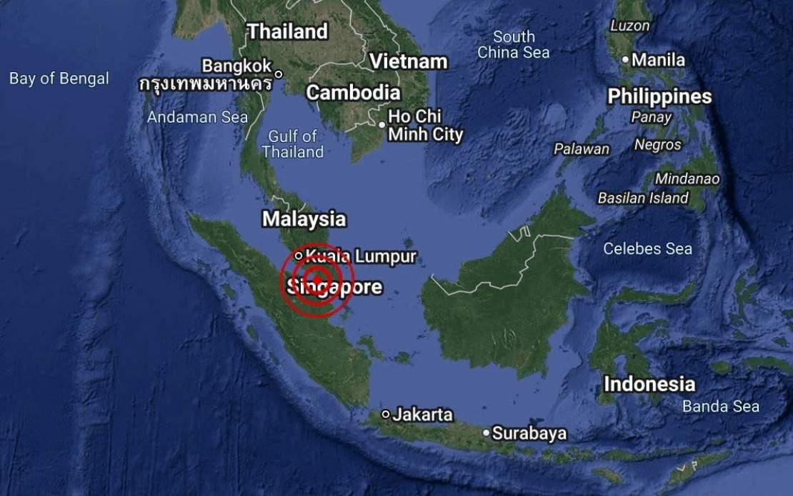
A minor seismic event rattled waters off the Johor coast on Tuesday afternoon when a 3.1-magnitude earthquake struck approximately 18 kilometres south-west of Batu Pahat. The tremor occurred at 4:12 pm with its epicentre positioned at coordinates 1.7 degrees north and 102.8 degrees east, according to data from Malaysia's Meteorological Department (MetMalaysia). The shallow-intensity quake was too weak to cause significant ground shaking or structural concerns but was sufficient to be detected by the National Weather and Earthquake Operations Centre's monitoring systems.
Malaysia's meteorological authorities moved swiftly to reassure the public and coastal communities following the event. In an immediate statement released the same day, MetMalaysia confirmed that no tsunami threat had been generated by the earthquake. This assessment aligns with the relatively modest magnitude of the tremor and its offshore location, which typically result in negligible wave-energy propagation. The rapid confirmation from national authorities serves to prevent unnecessary alarm among residents in Batu Pahat and surrounding districts, particularly among communities with historical awareness of tsunami risks in the wider Indo-Pacific region.
Earthquakes of this magnitude are generally not felt by most people and rarely cause damage to structures or infrastructure. The 3.1-magnitude reading places this event in the lower range of perceptible seismic activity, though sensitive instruments and individuals located close to the epicentre may have detected subtle vibrations or minor ground movement. For Malaysia, which sits relatively far from major active tectonic plate boundaries, such events are typically infrequent and mild compared to the seismic hazards experienced by neighbouring countries like Indonesia or the Philippines, which straddle more tectonically active zones.
The Batu Pahat area, situated on the western coast of Johor and serving as a significant port and commercial centre, is generally considered a low-seismicity zone. The presence of monitoring systems and rapid-response protocols from MetMalaysia demonstrates Malaysia's commitment to earthquake preparedness and public safety communication, despite the nation's relatively stable geological position. Such infrastructure investments reflect lessons learned from regional seismic events and growing awareness of the importance of early warning systems in Southeast Asia.
For Malaysian residents and policymakers, incidents like this serve as reminders of the importance of maintaining robust disaster preparedness frameworks. While the current earthquake posed minimal threat, the protocols activated by MetMalaysia exemplify how effective inter-agency coordination and clear public communication can prevent panic and confusion during natural hazard events. The department's swift announcement regarding tsunami safety was particularly important given that coastal populations often have heightened anxiety regarding seismic events, particularly following high-profile earthquakes and tsunamis that have affected the region in recent decades.
The earthquake's occurrence in offshore waters rather than on land reflects the broader geological characteristics of the region. Malaysia's position on a stable continental plate means that most seismic activity, when it does occur, tends to cluster in maritime zones along plate boundaries or in areas of minor geological stress. This geographic reality has historically insulated Malaysia from the devastating earthquakes that periodically strike more tectonically active neighbours, though it does not eliminate the possibility of future tremors or the need for continued scientific monitoring and public education.
MetMalaysia's National Weather and Earthquake Operations Centre plays a crucial role in Malaysia's disaster management infrastructure, continuously monitoring seismic activity and providing timely alerts to relevant authorities and the public. The rapid deployment of information following Tuesday's event underscores the centre's operational efficiency and commitment to transparency. In an era where misinformation can spread rapidly through social media, official channels and clear, factual updates from credible government agencies become increasingly vital for maintaining public confidence and preventing rumour-driven panic.
For the broader Southeast Asian context, incidents of this nature highlight the region's varied seismic profiles and the differing levels of earthquake risk facing different nations. While Indonesia and the Philippines experience frequent, sometimes severe earthquakes due to their location along the Pacific Ring of Fire, Malaysia's more sheltered geological position has allowed it to focus its disaster preparedness efforts on other hazards, such as flooding and landslides. Nevertheless, maintaining earthquake monitoring capabilities and public awareness remains an essential component of comprehensive disaster risk reduction in any nation.

