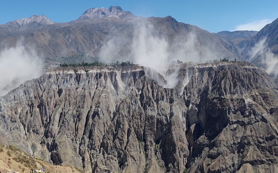
A significant seismic event rocked southern Peru on Thursday afternoon when a 6.7 magnitude earthquake struck the Parinacochas province in the Ayacucho department, according to readings from the US Geological Survey. The Geophysical Institute of Peru (IGP) recorded the tremor at slightly higher magnitude, measuring 7.2, occurring at approximately 1 pm local time with its epicentre positioned roughly 35 kilometres north of Coracora. The intermediate depth of the quake, extending 108 kilometres into the earth's crust, played a crucial role in limiting surface damage and casualties.
The substantial depth of this earthquake proved instrumental in dampening the destructive potential that typically accompanies such high-magnitude events. Geophysicists explained that the 108-kilometre depth allowed the seismic energy to dissipate gradually through the rock layers, reducing the intensity experienced at ground level. The National Seismological Centre under the IGP calculated a Mercalli intensity rating of III-IV at the epicentre, indicating light to moderate shaking rather than the violent tremors that would result from a shallow-focus earthquake of comparable magnitude. This characteristic of intermediate-depth earthquakes often means that communities directly above the epicentre experience less severe shaking than distance measurements might suggest.
Preliminary reports from Peruvian authorities and disaster management agencies confirmed no deaths or major structural damage in the immediate aftermath of the earthquake. This favourable outcome reflected both the protective effect of the depth and the relatively sparse population in the mountainous Ayacucho region where the epicentre was located. Residents and monitoring stations across the southern and central portions of Peru clearly felt the tremors, with the shaking detectible even in Lima, the country's capital situated hundreds of kilometres away on the Pacific coast. This wide distribution of felt reports underscored the earthquake's substantial energy release despite the absence of catastrophic impacts.
The timing of this event comes amid a broader pattern of heightened seismic activity affecting both Peru's northern and southern zones. Geologists monitoring the region have observed an uptick in tremor frequency over recent weeks, prompting increased caution among disaster preparedness officials. This elevated activity reflects the region's precarious geological position rather than any unusual anomaly. Peru sits directly along the Pacific Ring of Fire, the planetary arc of intense tectonic activity that encompasses approximately 75 percent of the world's active volcanoes and generates roughly 90 percent of recorded earthquakes globally.
The IGP responded to Thursday's tremor by issuing public guidance emphasising the importance of sustained vigilance and practical preparedness measures. Officials recommended that households review and practise their evacuation protocols, ensuring family members understand designated escape routes and assembly points. The institute also encouraged residents to maintain stocked emergency supply kits containing essential items such as water, non-perishable food, first aid materials, and flashlights. These recommendations reflect standard disaster preparedness protocols developed over decades of seismic risk management in Peru.
Historical context provides sobering perspective on the potential consequences of major earthquakes in Peru. The 2007 earthquake that struck the Ica region with a magnitude of 7.9 resulted in nearly 600 fatalities and caused extensive destruction across a wide area. That event demonstrated how earthquakes in Peru, despite occurring along the same tectonic boundaries, can produce vastly different outcomes depending on depth, location, time of day, and building construction standards. The contrast between Thursday's incident and the 2007 disaster illustrates how geological characteristics combine with human factors to determine earthquake impacts.
For Malaysian and Southeast Asian observers, Peru's experience offers instructive lessons about earthquake preparedness and response. While Malaysia experiences less frequent seismic events than Peru, the region sits near active tectonic zones, particularly in areas including Sabah and Sarawak. The principles underlying Peru's approach to seismic monitoring and public education—maintaining robust scientific observation networks, communicating clearly with the public, and emphasising household preparedness—represent best practices applicable across the Asia-Pacific region. The USGS and similar international scientific organisations facilitate knowledge sharing about earthquake monitoring technologies and early warning systems that benefit countries worldwide.
Peru's sophisticated earthquake monitoring infrastructure, operated through the IGP's various centres including the National Seismological Centre, demonstrates the importance of sustained investment in geophysical monitoring. The ability to rapidly calculate earthquake magnitude, depth, and epicentre location enables prompt assessment of hazard levels and appropriate response actions. Countries throughout Southeast Asia have increasingly recognised the value of comparable investment in seismic monitoring capabilities, recognising that accurate, timely information saves lives and allows authorities to focus resources efficiently.
The broader regional context of Pacific Ring of Fire activity means that Peru frequently experiences earthquakes as a normal geological feature. Rather than treating earthquakes as aberrations, Peruvian society has institutionalised preparation and response mechanisms reflecting a mature understanding of living with seismic risk. Public education campaigns, building codes emphasising earthquake resistance, and regular disaster drills form part of the cultural and institutional landscape. This normalisation of preparedness contrasts with regions where earthquake awareness remains episodic, emerging primarily after destructive events.
As monitoring continues in the days following Thursday's earthquake, officials will analyse detailed seismic data to assess whether the event represents an isolated occurrence or part of a broader pattern suggesting stress release along regional fault lines. Such analysis informs forecasting models and helps guide resource allocation for preparedness initiatives. The apparent calm in the hours following the initial tremor suggests no immediate secondary hazards, though authorities maintain heightened monitoring protocols as a precautionary measure. Peruvian seismologists recognise that major earthquakes sometimes trigger aftershock sequences, necessitating continued public vigilance even when initial impacts prove limited.

