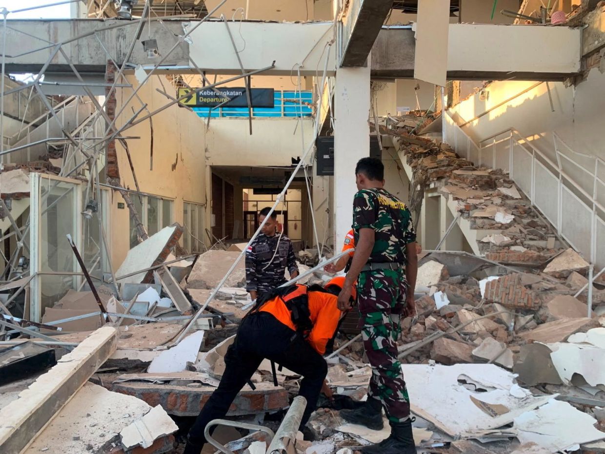
A potent magnitude 7.7 earthquake rocked Indonesia's Flores region in the predawn hours of Saturday, August 15, triggering widespread structural damage and loss of life in one of the world's most seismically active zones. The tremor, which struck at 5:58 a.m. local time with its epicenter positioned 68 kilometers north-northwest of the city of Ende in East Nusa Tenggara province, flattened buildings and homes while sending residents fleeing in terror. The U.S. Geological Survey recorded the quake's depth at 10 kilometers, making it a shallow rupture capable of inflicting severe surface-level destruction. Early reports from emergency officials confirmed at least two fatalities and two additional injuries, though casualty figures remained preliminary as rescue teams fanned out across the affected area.
The disaster prompted an immediate tsunami warning across multiple provinces in eastern Indonesia, including parts of East Nusa Tenggara, West Nusa Tenggara, South Sulawesi and Southeast Sulawesi. Coastal residents heeded evacuation orders and moved inland and to higher elevations as a precautionary measure. However, the Indonesian Meteorology, Climatology and Geophysics Agency lifted the warning after conducting detailed monitoring of sea levels, determining that no dangerous wave activity had materialized to threaten communities along the shoreline. This swift assessment allowed residents to return to affected areas and begin the critical work of search and rescue operations.
Damage assessments unfolded rapidly across Flores island, with eyewitness accounts painting a picture of substantial destruction. Yohanna Embu, a resident of Sikka regency, described how the violent ground motion toppled numerous structures throughout the locality. She noted that the waiting room at the Maumere port terminal had completely collapsed, underscoring the indiscriminate force of the seismic waves that radiated outward from the epicenter. Multiple buildings across the region sustained severe structural compromises, forcing authorities to conduct extensive evacuations of facilities containing vulnerable populations.
Hospital evacuations proceeded with urgency as medical staff prioritized patient safety in the immediate aftermath. Television footage captured dramatic scenes of patients being moved outdoors as precautionary measures, with hospital personnel rapidly establishing temporary treatment zones in open areas. Medical equipment including beds, intravenous stands, and oxygen cylinders were hastily relocated outside as administrators worked to maintain continuity of care while assessing building safety. These makeshift medical facilities reflected the resourcefulness of healthcare workers adapting to emergency conditions with minimal advance preparation.
Religious institutions suffered particularly severe consequences from the earthquake's impact. Students and nuns at St. Peter Major Seminary, known locally as Ritapiret Seminary, were attending morning Mass when the assembly hall roof suddenly gave way. Rev. Guidelbertus Tanga, the seminary's rector, recounted how the panicked community fled the collapsing structure as debris rained down. The incident resulted in serious injuries, with at least one priest sustaining a broken leg after leaping from a second-story window in desperation to escape the falling roof. The seminary, situated on the predominantly Catholic island of Flores, serves as a major religious and educational institution, making the damage particularly significant for the local community.
Flores island's vulnerability to major seismic events stems from its geographical positioning within Indonesia's complex tectonic framework. The nation's location along the Pacific Ring of Fire—a vast arc encompassing volcanoes and active fault lines encircling the Pacific Basin—subjects the archipelago to frequent and often violent seismic activity. With over 17,000 islands scattered across three time zones and spanning thousands of kilometers from west to east, Indonesia straddles multiple convergent plate boundaries where the earth's crust constantly shifts and grinds. This geological reality means that devastating earthquakes represent a recurring hazard rather than exceptional occurrences.
Historical precedent underscores the catastrophic potential of major seismic events in this region. In December 1992, a powerful earthquake triggered a devastating tsunami that inundated Flores and neighboring islands, claiming approximately 2,500 lives across the southeastern portion of the archipelago. That tragedy demonstrated how underwater earthquakes near Flores can generate massive wave formations capable of obliterating coastal settlements within minutes. The December 1992 disaster remains seared into the collective memory of East Nusa Tenggara residents, making Saturday's quake a fresh reminder of nature's raw destructive capacity.
For Malaysian observers and regional policymakers, the Indonesian earthquake carries important implications regarding disaster preparedness and early warning systems across Southeast Asia. The rapid lifting of tsunami warnings following the August 15 tremor reflected improvements in monitoring technology and coordination protocols since the catastrophic 2004 Indian Ocean tsunami, which claimed nearly 170,000 lives across the region including Malaysian victims. However, the incident also highlighted ongoing challenges in building construction standards and emergency response capacity, particularly in remote eastern regions where infrastructure development has lagged behind western portions of Indonesia.
The earthquake also reinforces the interconnected vulnerability of Southeast Asia to seismic hazards. Malaysia's eastern coast, particularly Sabah and Sarawak, lies within proximity to active fault systems and experiences occasional tremors transmitted from Indonesian sources. The August 15 earthquake in Flores, though distant from Malaysia's population centers, serves as a reminder that the region's tectonic activity knows no political boundaries. Seismic events affecting Indonesian islands can potentially generate secondary effects including tsunamis that traverse maritime boundaries and impact distant coastlines.
Rescue and recovery operations will undoubtedly dominate the coming weeks in East Nusa Tenggara as authorities catalog damage, identify deceased victims, and support displaced residents. The shallow depth of Saturday's quake likely resulted in more pronounced ground shaking in the epicentral region compared to deeper ruptures, potentially explaining the widespread building damage despite the area's remoteness from major metropolitan centers. Engineers and disaster management specialists will likely conduct detailed post-event investigations to understand failure modes of damaged structures and identify improvements to building codes throughout the eastern Indonesian provinces.

