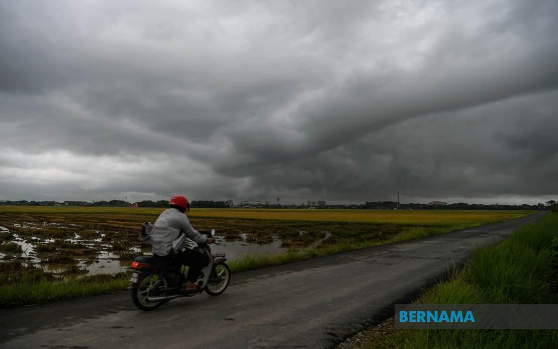
The Malaysian Meteorological Department has mobilised a comprehensive weather alert system covering a vast swathe of the country, cautioning residents and commuters across multiple states to prepare for severe thunderstorm conditions expected to persist until 9pm. The warning encompasses regions stretching from the northern peninsula through the central and southern zones, while also extending to East Malaysia, signalling a particularly active weather pattern affecting the nation simultaneously.
In the northern peninsula, the departments alert captures a substantial portion of Kedah, singling out Kuala Muda, Baling, Kulim and Bandar Baharu as zones where thunderstorms coupled with torrential downpours and gusty winds pose immediate hazards. Penang residents across the Northeast district alongside the three Seberang Perai administrative zones—Utara, Tengah and Selatan—should also brace for deteriorating conditions, suggesting the nor'east coast is experiencing concentrated atmospheric instability.
Perak experiences an even more expansive alert footprint, with the department designating ten districts as vulnerable. These span from the northern coastal strip through Kerian, Larut, Matang and Selama into the interior regions of Hulu Perak, Kuala Kangsar, Kinta, Kampar and the southern expanse of Batang Padang. This horizontal band across Perak indicates that weather systems are not confined to coastal or elevated areas but are affecting the entire state's geographic spectrum. Notably, all of Kelantan finds itself under the warning, suggesting the entire east coast northern tier faces similar meteorological pressures.
The east coast alert extends southward through Terengganu, where six districts—Besut, Hulu Terengganu, Kuala Terengganu, Marang, Dungun and Kemaman—face the impending weather system. This pattern hints at a significant pressure system moving through or stalling over the region, creating sustained instability. Pahang's alert affects primarily its central and eastern territories: Cameron Highlands in the mountainous interior, Lipis, Jerantut in the interior-eastern transition zone, and the coastal trio of Kuantan, Pekan and Rompin, indicating the system impacts both highland and lowland areas.
In southern Peninsular Malaysia, Johor's eight affected districts reveal that the weather disturbance penetrates deep into the south. Tangkak and Segamat in the interior, Muar and Kluang in the western and central zones, and the coastal and border districts of Mersing, Kulai, Kota Tinggi and Johor Bahru demonstrate that the system's reach extends across the state's entire breadth and length. For Malaysian commuters and residents, such widespread simultaneous warnings typically indicate atmospheric conditions requiring heightened vigilance regarding flooding risks, travel disruptions and electrical hazards associated with lightning activity.
East Malaysia experiences comparable disruption, with Sarawak's alert covering five geographic clusters. Sibu on the central coast, the Mukah division encompassing Matu and Dalat, Kapit's Song area in the interior, Bintulu's Tatau zone, and the northwestern Miri division including Beluru, Miri and Marudi collectively represent a significant swath of Sarawak's populated and commercial zones. This distribution suggests weather patterns affect both river-based communities and coastal population centres across the state.
Sabah's warning similarly blankets critical areas across the state. The Interior Division districts of Sipitang, Kuala Penyu, Beaufort and Tambunan face the alert, as do the more densely populated West Coast zones of Papar, Penampang and Ranau. The inclusion of both interior highland regions and coastal lowland areas mirrors the pattern seen on the peninsula. Additionally, the Federal Territory of Labuan, positioned strategically in Brunei Bay, comes under the alert envelope, reflecting the geographic extent of the prevailing weather system.
For Malaysia's broader population, such comprehensive simultaneous warnings across geographically dispersed regions indicate a significant meteorological event warranting serious preparation. Residents in affected areas should secure loose outdoor items, avoid unnecessary travel during peak thunderstorm activity, and remain alert to flash flooding possibilities, particularly in low-lying zones and near water courses. Those engaged in outdoor occupations or dependent on road networks should factor substantial delays and disruptions into their schedules.
The timing of the warning extending through 9pm suggests the system's most intense phase may concentrate during evening hours, potentially impacting the commute home for urban workers. Authorities typically issue such widespread alerts when atmospheric models indicate sustained convective activity rather than isolated or brief incidents. For Malaysian businesses reliant on logistics, supply chains and public-facing operations, the afternoon and evening window presents operational challenges requiring contingency planning. Schools and public facilities in affected zones may also need to implement weather protocols for student and staff safety.
Regional context matters significantly for understanding this weather event. Malaysia's equatorial and tropical monsoon climate creates regular thunderstorm activity, particularly during transition periods between monsoon systems. However, when a single weather pattern simultaneously threatens such geographically extensive territories spanning both peninsula and East Malaysia, it typically indicates either a particularly robust weather system or a broader atmospheric condition creating widespread instability. Residents in long-settled urban areas generally possess infrastructure accustomed to heavy rainfall, yet rural and newly developed zones may prove more vulnerable.
For aviation and maritime sectors, such alerts carry particular weight. Thunderstorms with strong winds pose direct hazards to aircraft operations and maritime safety, with visibility reduction, wind shear and lightning constituting primary concerns. Regional airports and ports typically implement enhanced monitoring protocols during such warnings, potentially affecting schedules for both cargo and passenger operations throughout the affected zones.
Looking ahead, Malaysian residents should monitor MetMalaysia's updates beyond the 9pm window, as evening thunderstorm systems occasionally persist or redevelop into early morning hours depending on atmospheric conditions. The department's alert system typically refines its forecasts within three to four hour intervals, allowing for more precise guidance as weather patterns evolve. Those in particularly vulnerable locations—flood-prone areas, near rivers and coastal zones—should remain especially attentive to official weather updates and local authority communications throughout the evening period.

