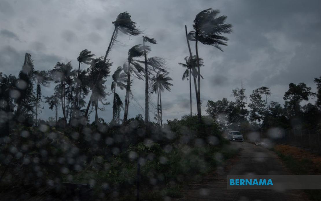
The Malaysian Meteorological Department (MetMalaysia) has activated a widespread weather alert covering nine states after issuing an advisory at 2.40 pm, cautioning residents to brace for thunderstorms, heavy precipitation, and gusty winds extending through the early evening. The simultaneous alert across such a broad geographic span underscores the scale of the meteorological system moving through Malaysian airspace and highlights the unpredictable nature of atmospheric conditions during this monsoon transition period.
In the northern region, Kedah faces the most extensive district coverage, with six districts including Baling, Sik, Kulim, Kuala Muda, Pendang, and Yan all falling within the warning zone. Neighbouring Penang experiences a slightly more concentrated impact, limited to the two Seberang Perai divisions—Utara and Tengah—which together comprise a significant population corridor along the mainland portion of the state. This northern concentration reflects how weather systems can produce variable impacts across geographically proximate areas, with some districts experiencing more intense activity than others depending on local topographic and atmospheric factors.
The central spine of Peninsular Malaysia stretches the warning footprint considerably eastward and southward. Perak, positioned at a crucial geographic crossroads, accounts for seven affected districts spanning from coastal Hilir Perak through the highland terrain of Batang Padang and the industrial heartland of Kinta and Kampar. The inclusion of mountainous Cameron Highlands in Pahang alongside populated areas like Temerloh suggests the system's capacity to generate severe conditions across diverse elevation zones. Meanwhile, Terengganu's east coast districts—Dungun, Marang, Kuala Terengganu, and Kuala Nerus—indicate that maritime areas also face significant risk, where thunderstorms can intensify rapidly over coastal waters and impact adjacent land areas.
Southern Peninsular Malaysia experiences more selective impact, with Negeri Sembilan affected across five districts including the state capital Seremban, while only Johor's Segamat falls under the warning parameters. This geographic selectivity demonstrates how thunderstorm systems, though large, maintain discrete boundaries rather than blanket coverage, creating pockets of heightened risk punctuating otherwise calmer zones. The sparing of most southern Johor districts suggests the system's southern extent remains well-defined, limiting widespread disruption across the nation's southernmost peninsula region.
East Malaysian states receive equally serious attention from MetMalaysia's monitoring apparatus. Sarawak's warning encompasses a diverse range of districts from the northern boundary areas of Limbang and Miri's Marudi district through central divisions including Mukah, Sibu, Sarikei, and the Bintulu zone. This extensive coverage across the state's length reflects how weather systems moving across Borneo can produce significant precipitation effects across substantial distances. The inclusion of both riverine and interior districts suggests that flooding potential extends beyond coastal plains into areas dependent on river navigation and connectivity.
Sabah's affected zones concentrate on specific geographic regions rather than blanket state coverage. The Interior Division encompasses six districts—Keningau, Tambunan, Membakut, Tenom, Sipitang, and Beaufort—representing the highland and foothill zones where topographic uplift frequently intensifies rainfall. The West Coast designation captures the developed corridor linking Kota Kinabalu to surrounding urban centres, while Kudat's Kota Marudu represents the northern extremity of vulnerable districts. This pattern reveals how Sabah's mountainous terrain creates natural zones of heightened meteorological activity that demand prioritised monitoring and advance warning systems.
MetMalaysia's decision to cast such a geographically extensive alert reflects institutional protocols balancing precaution against alert fatigue. The four-hour window until 5 pm provides residents adequate time to secure loose outdoor items, seek shelter before conditions peak, and adjust transportation plans. For businesses, particularly those in agriculture, transportation, and outdoor services, such warnings facilitate contingency activations and workforce safety measures. The specificity of district-level alerts enables local authorities and disaster management agencies to concentrate resources where greatest need concentrates, rather than dispersing response capacity across entire states.
Thunderstorm warnings during Malaysia's monsoon transition periods carry particular significance given the nation's vulnerability to flash flooding and landslides when heavy rain coincides with saturated soil conditions and steep terrain. The August timeframe places this alert within the transition between the Southwest Monsoon and the inter-monsoon period, when atmospheric instability frequently generates convective activity. Residents in the identified districts, particularly those in flood-prone low-lying areas and near riverine systems, should exercise heightened vigilance and remain alert to evacuation directives from local disaster management authorities.
The simultaneous impact across Peninsular Malaysia and East Malaysia indicates a large-scale meteorological feature rather than localised convection, though individual thunderstorm cells within the broader system will vary in intensity and duration. MetMalaysia's real-time monitoring capacity allows for alert refinement as atmospheric conditions evolve, potentially expanding or contracting the warning zone as the system's trajectory becomes clearer. Residents should remain tuned to official updates and SMS alert systems, particularly those in areas proximate to the warning boundaries where conditions may shift with short notice.
For transport and logistics sectors operating across the affected states, the five-hour alert window demands rapid decision-making regarding route alterations and cargo security. Flights departing or arriving at regional airports may face delays if visibility degrades substantially or downdrafts create unsafe runway conditions. Maritime traffic along Sarawak's and Sabah's coastal waters faces particular hazard from the combination of thunderstorms and gusty winds, which can generate dangerous sea conditions within minutes. Emergency services across all nine affected states should anticipate increased callouts for weather-related incidents and position response teams strategically in vulnerable zones.

