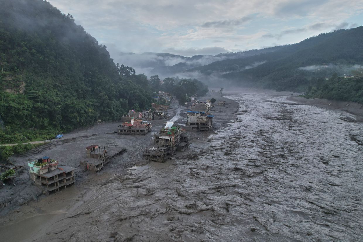
The catastrophic floods that swept through Nepal last week killed at least 800 people and left over 3,000 missing, yet survivors had mere minutes—sometimes just five—to flee the onrushing waters. This devastating toll underscores a fundamental vulnerability in how the Himalayan region monitors and responds to mountain disasters: the absence of adequate high-altitude weather stations and the lack of coordinated data sharing between Nepal and its northern neighbour China. Dharam Raj Uprety, who heads Nepal's National Disaster Risk Reduction and Management Authority, described the situation bluntly to international media, emphasising that the nation's inability to receive timely warnings stems directly from gaps in trans-boundary information systems and the sparse coverage of monitoring infrastructure across the highest elevations.
The immediate trigger for the disaster was a glacial collapse on August 26 that unleashed torrents of ice, mud, and rock down a valley, obliterating settlements and infrastructure in its path. Footage captured the terrifying final moments as residents scrambled to escape before walls of water and debris consumed entire communities, demolished bridges, severed power lines, and swept away vehicles and boulders. The scale of destruction has prompted preliminary estimates that reconstruction costs could exceed US$5 billion, potentially requiring seven to eight years of rebuilding—a timeline comparable to Nepal's recovery from the devastating 2015 earthquake, according to assessments by Binod Chaudhary, the country's sole billionaire and head of the Chaudhary Group.
The root cause of this warning gap lies in Nepal's extremely limited capacity to monitor conditions in its high-altitude zones. Installing and maintaining weather stations at extreme elevations demands substantial financial investment and technical expertise that Nepal currently lacks. This leaves authorities with minimal visibility into rapidly shifting temperature patterns, permafrost destabilisation, and the emergence of new glacial hazards—precisely the phenomena that can trigger mountain disasters. While Nepal maintains some monitoring infrastructure in lower elevations and river valleys downstream, vast stretches of the high Himalayas remain essentially unobserved, creating blind spots where dangerous changes accumulate without detection.
Climate change is intensifying this vulnerability, though scientists caution against attributing the specific collapse directly to warming alone. Rising temperatures are destabilising glaciers and mountain slopes faster than Nepal can develop the systems needed to track these changes. Satellite analysis suggests that bedrock beneath the failed glacier collapsed, initiating the cascading disaster. Warming temperatures weaken permafrost that normally binds high-altitude slopes together, making such failures more likely in the future. The situation is particularly acute because the processes of change operate across political boundaries—weather systems, glacial lakes, and mountain geology respect no national borders, yet Nepal and China lack the institutional mechanisms to share crucial monitoring data and early warnings.
China's response has been measured but somewhat opaque. President Xi Jinping called for accelerated surveys of glaciers and glacial lakes across the Tibetan Plateau to prevent future disasters, and China's Communist Party ordered stronger monitoring and early-warning systems. However, the Chinese Embassy in Kathmandu has only stated vaguely that China "always made every effort, within the limits of existing technologies, to conduct monitoring, assessment and analysis and have shared important information with the Nepali side in a timely manner." The embassy did not clarify whether China had issued any specific warning to Nepal about the August 26 catastrophe, leaving questions about what data, if any, was transmitted and how effectively it was used.
The absence of transboundary data-sharing mechanisms represents a critical infrastructure failure that extends beyond this single disaster. Uprety identified this gap as one of Nepal's "biggest challenges," noting that the lack of "trans-boundary data seeding mechanisms"—formal systems for exchanging weather and climate information across national borders—fundamentally constrains the nation's ability to anticipate threats originating in remote mountain areas. Many of Nepal's most dangerous glaciers and glacial lakes are in regions where Chinese territory lies upstream, meaning that comprehensive early warning requires information flows that currently do not exist in any systematic or reliable way.
The implications for Nepal's tourism sector and broader economic development are substantial. Tourism is a vital source of employment and foreign exchange for the Himalayan economy, yet major trekking routes and mountaineering destinations depend on safe conditions that cannot be ensured without robust hazard monitoring. Communities living in mountain valleys face existential risk when warning systems fail to provide even minutes of advance notice. Reconstruction will be prolonged and costly, but more fundamentally, continued vulnerability to unwarned disasters threatens long-term investment in mountain regions.
Nepali authorities recognise the urgency of reform. Uprety's team at the NDRRMA has drafted a roadmap for improving early-warning systems that is expected to be endorsed soon. The strategy prioritises giving communities meaningful preparation time—ideally several hours or more rather than the current five-minute window—to evacuate and protect assets. Success will require substantial investment in new monitoring infrastructure, trained personnel, and crucially, the establishment of formal channels for sharing data and warnings with China and other neighbouring countries. The roadmap represents a step toward resilience, but implementation will face resource constraints and the diplomatic complexities of negotiating cross-border information agreements.
The broader regional context makes cross-border cooperation particularly essential. The Himalayas are experiencing accelerating change driven by climate warming, making glacial hazards increasingly unpredictable. Nepal is not alone in this vulnerability—Bhutan, India, and Pakistan all face similar threats from high-altitude glacial lakes and unstable slopes. Regional mechanisms for data sharing and coordinated early warning could save lives across multiple nations and reduce the economic disruption caused by mountain disasters. Until such systems are established, communities in the highest inhabited regions will remain exposed to catastrophic risks that arrive with minimal warning, as the victims of last week's floods tragically demonstrated. The challenge now is whether political will and available resources can be mobilised to prevent similar disasters in the future.

