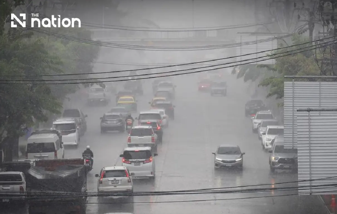
Thailand is girding for a significant weather crisis as the Meteorological Department escalated its alert level on Wednesday, warning that exceptionally heavy rainfall spanning the next three days could unleash destructive flash floods across the northern and northeastern regions. The ninth warning, issued at 5pm on August 19, reflects growing concern that the confluence of two major atmospheric systems—a monsoon trough sweeping through the North and upper Northeast, combined with an unusually vigorous southwest monsoon over the Andaman Sea and adjacent maritime zones—will overwhelm drainage infrastructure and trigger rapid water accumulation in vulnerable communities.
The meteorological outlook signals an intensifying pattern rather than a passing shower system. Communities positioned near waterways, foothill settlements, and low-lying terrain face the greatest jeopardy, as accumulated precipitation from multiple days of storms will funnel into natural drainage channels with little opportunity for absorption. Residents in these areas have been instructed to remain vigilant about rainfall measurements and water levels, with particular emphasis on monitoring conditions throughout the three-day forecast window. The department's repeated warnings underscore the severity of the situation—issuing nine separate alerts within a compressed timeframe is uncommon and signals genuine apprehension about potential casualties and infrastructure damage.
Northern Thailand will experience the most intense meteorological activity, with thunderstorms expected across 80 per cent of the region from Wednesday evening through Thursday. The seven provinces designated for very heavy rain—Mae Hong Son, Lampang, Nan, Phrae, Uttaradit, Phitsanulok and Phetchabun—represent some of Thailand's most topographically challenging terrain, where steep hillsides and narrow valleys concentrate runoff into powerful torrents. An additional eight provinces including Chiang Mai, Chiang Rai, and Kamphaeng Phet are forecast to receive heavy precipitation, creating a broad swath of dangerous conditions across virtually the entire northern region.
The Northeast presents an equally formidable challenge, with 80 per cent storm coverage predicted across the region's twelve provinces. Very heavy rain is anticipated in eight provinces including Loei, Nong Khai, Bueng Kan and Udon Thani, areas where rapid drainage is complicated by flatter topography but where river systems can overwhelm their banks during sustained heavy rainfall. The sheer geographic scale of the warning—covering both the North and Northeast simultaneously—means that Thai emergency services will be stretched managing multiple simultaneous crisis situations across a vast territory.
Beyond the northern and northeastern regions, the Central and Eastern areas will also experience significant precipitation, though with somewhat lower probability of flash flooding due to flatter terrain and better drainage infrastructure. The Central provinces including Nakhon Sawan, Lop Buri and Kanchanaburi face 60 per cent thunderstorm coverage, while the Eastern region expects 70 per cent storm activity, with Trat province potentially receiving very heavy rainfall. Even the capital region and its surroundings are forecast to experience thunderstorms over 60 per cent of the area, suggesting that Bangkok's metropolitan drainage systems may face above-normal stress.
Maritime safety considerations add another dimension to the meteorological crisis. The same atmospheric systems driving rainfall inland are generating hazardous seas across the Andaman Sea and Gulf of Thailand. Wave heights in the upper reaches of both water bodies are expected to reach two to three metres under normal conditions, potentially exceeding three metres during thunderstorm activity. Small vessels operating in the upper Andaman Sea and upper Gulf have been explicitly directed to remain ashore through August 21, reflecting genuine concerns about capsizing risks and rescue difficulties during the peak weather period.
Thailand's transportation network faces considerable disruption potential, as roads through low-lying areas with historical flood problems become impassable during heavy downpours. Motorists have been cautioned to avoid these routes and plan journeys carefully, recognizing that temporary inundation can develop rapidly in areas where water drainage is inadequate. This advisory carries practical implications for regional commerce, as trucking routes connecting northern and northeastern provinces to Bangkok and southern Thailand may experience bottlenecks or complete closure if flooding develops on major highways.
The convergence of these weather systems reflects broader patterns of Southeast Asian monsoon dynamics that consistently challenge Thailand's infrastructure and emergency preparedness during peak rainfall seasons. The southwest monsoon, which typically brings seasonal rains to mainland Southeast Asia, has been notably vigorous this year, while the monsoon trough—a band of low pressure that triggers thunderstorm development—is positioned precisely where it can draw moisture-laden air masses into collision zones that generate extreme precipitation.
For Malaysia and other Southeast Asian nations, Thailand's weather crisis serves as a reminder that regional monsoon patterns create transnational weather impacts. Heavy rainfall across northern Thailand can affect downstream water flows affecting Laos and Cambodia, while similar weather systems may eventually influence conditions across the Southeast Asian region. Malaysians familiar with their own monsoon seasons will recognize the meteorological dynamics at play—the combination of trough systems with strong directional wind patterns creates precisely the conditions that trigger Malaysia's worst flooding events.
Thailand's three-day alert period represents a critical window for emergency preparedness. Provincial authorities are expected to position rescue equipment, pre-position personnel in high-risk areas, and activate emergency operations centers. Families in vulnerable areas should finalize evacuation plans, move valuables to elevated locations, and maintain communication contact with local emergency services. The department's decision to issue multiple warnings suggests that conditions may evolve unpredictably, potentially intensifying beyond current forecasts if atmospheric systems develop differently than anticipated.
The economic implications of significant flooding across northern and northeastern Thailand would be substantial. These regions contribute significantly to Thailand's agricultural output, with rice paddies, fruit orchards, and vegetables occupying vast agricultural zones vulnerable to water damage. Flash flooding can devastate crops within hours, while inundation of low-lying farmland may require weeks for water to recede and fields to dry sufficiently for replanting. Manufacturing facilities and supply chains dependent on northeastern and northern production bases could experience disruption if roads become impassable or power infrastructure sustains damage.
As the forecast period approaches, Thai residents should maintain active engagement with official weather updates and emergency service announcements. The Meteorological Department's ninth warning signals that this is not a routine weather event but rather a significant hazard requiring serious preparation and caution. Communities in high-risk areas should prioritize family safety, maintain emergency supplies, and stay informed about evolving conditions through the three-day critical period.

