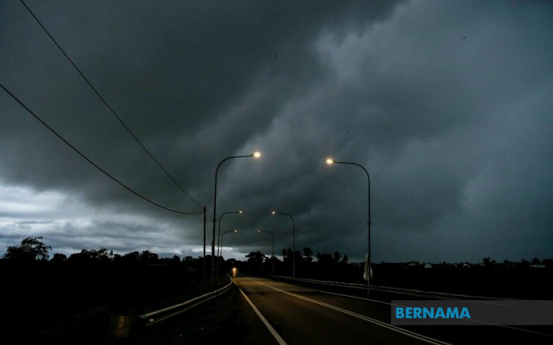
The Malaysian Meteorological Department has issued a weather advisory covering extensive regions across Peninsular Malaysia, Sabah and Sarawak, warning residents and commuters to prepare for severe thunderstorms accompanied by intense rainfall and gusty winds. The alert, effective until 6 PM, encompasses nine states plus the federal territories of Kuala Lumpur and Putrajaya, signalling a period of heightened weather instability across the nation.
In Peninsular Malaysia, the warning blankets a vast swath of territory from the southern region northward. Johor faces the threat of sudden downpours and electrical storm activity, whilst Negeri Sembilan residents should remain vigilant for rapidly changing conditions. Perak has been placed on alert across seven zones: Hulu Perak, Kuala Kangsar, Kinta, Kampar, Hilir Perak, Batang Padang and Muallim, reflecting the geographic spread of the expected weather system affecting the state.
The east coast states of Kelantan, Terengganu and Pahang sit directly in the path of the forecast thunderstorm belt. Kelantan's warning covers Tumpat, Pasir Mas, Jeli, Tanah Merah, Kuala Krai and Gua Musang, whilst Terengganu residents in Setiu, Kuala Nerus, Kuala Terengganu, Marang, Dungun and Kemaman should exercise caution. Pahang, encompassing both highland and lowland areas from Tanah Tinggi Cameron through to Pekan and Rompin, similarly faces the full spectrum of severe weather phenomena.
Within Selangor, seven districts have been highlighted in the meteorological alert: Sabak Bernam, Kuala Selangor, Hulu Selangor, Gombak, Petaling, Hulu Langat and Sepang. This coverage reflects how the weather system cuts across both the state's western coastal zones and its densely populated interior regions including areas surrounding the Klang Valley. The simultaneous warning for Kuala Lumpur and Putrajaya underscores the proximity and intensity of the expected atmospheric disturbance affecting the nation's administrative heartland.
East Malaysia has not been spared from the advisory. In Sarawak, the meteorological authority has issued warnings for Kuching, alongside Sarikei's Julau district, Sibu's Kanowit area, Mukah, Kapit's Song division, Bintulu incorporating both Bintulu and Sebauh, and Miri encompassing Subis, Beluru, Miri and Marudi proper. Limbang rounds out the list of affected Sarawakian regions, suggesting the weather pattern extends across the state's diverse geography from coastal to interior areas.
Sabah's coverage is equally comprehensive, divided into three geographical zones reflecting the state's physical configuration. The interior upland region designated Pedalaman includes Sipitang, Tenom, Beaufort, Nabawan, Keningau and Tambunan—areas where sudden weather deterioration carries particular risk for residents and agricultural operations. The West Coast zone covering Papar, Penampang, Kota Kinabalu, Tuaran and Ranau represents the state's most densely populated corridor and economic hub. Sandakan district to the northeast, including Tongod, Telupid, Beluran and Sandakan proper, completes the Sabahan contingent under alert.
The breadth of this meteorological warning—spanning from the southern peninsula through to northeastern Sabah and across Sarawak—indicates a significant weather system affecting much of the country simultaneously. Such extensive alerts typically suggest either monsoon-related activity or a substantial atmospheric disturbance capable of generating dangerous conditions across multiple climate zones. The specification of three weather phenomena—thunderstorms, heavy rain and strong winds—indicates residents should prepare for the complete range of severe weather impacts rather than isolated incidents.
Commuters and outdoor workers across the affected regions face legitimate safety concerns during the warning period. Thunderstorms can produce sudden wind gusts capable of downing tree branches and affecting vehicle stability, whilst the forecast heavy rainfall creates flooding risks in low-lying areas and may disrupt transportation networks. The electrical discharge component of thunderstorms poses direct hazard to individuals caught outdoors, particularly on elevated terrain or near bodies of water where electrical conductivity increases danger substantially.
For agricultural and rural communities within these zones, the advisory carries economic implications beyond immediate safety. Sudden intense rainfall can damage standing crops or disrupt harvest operations, whilst strong winds pose risks to structures and vegetation. The timing of such warnings allows farmers and rural enterprises brief opportunity to secure equipment and implement protective measures where feasible.
Public authorities across the warned regions typically activate standard severe weather protocols in response to meteorological department alerts. This includes positioning emergency response teams, monitoring drainage infrastructure in urban areas, and ensuring communication channels remain open for public advisories. Transport authorities may implement cautionary measures on highways and public transit systems where wind and reduced visibility affect operations.
The six-hour window of the warning—running until 6 PM—represents a critical afternoon and early evening period when weather activity typically intensifies in tropical regions. Weather systems of this scale can evolve unpredictably, and residents are advised to remain attentive to updated forecasts as the afternoon progresses. The Malaysian Meteorological Department regularly updates such advisories as conditions develop, and the public should monitor official channels for any extensions or modifications to the current warning.
For those within the affected territories, basic preparedness measures include securing loose outdoor items, avoiding unnecessary travel particularly through areas prone to flooding, and remaining indoors during the most severe weather development. Ensuring mobile devices are charged and emergency supplies accessible represents sensible precaution when facing widespread atmospheric instability affecting such extensive geographical areas.

