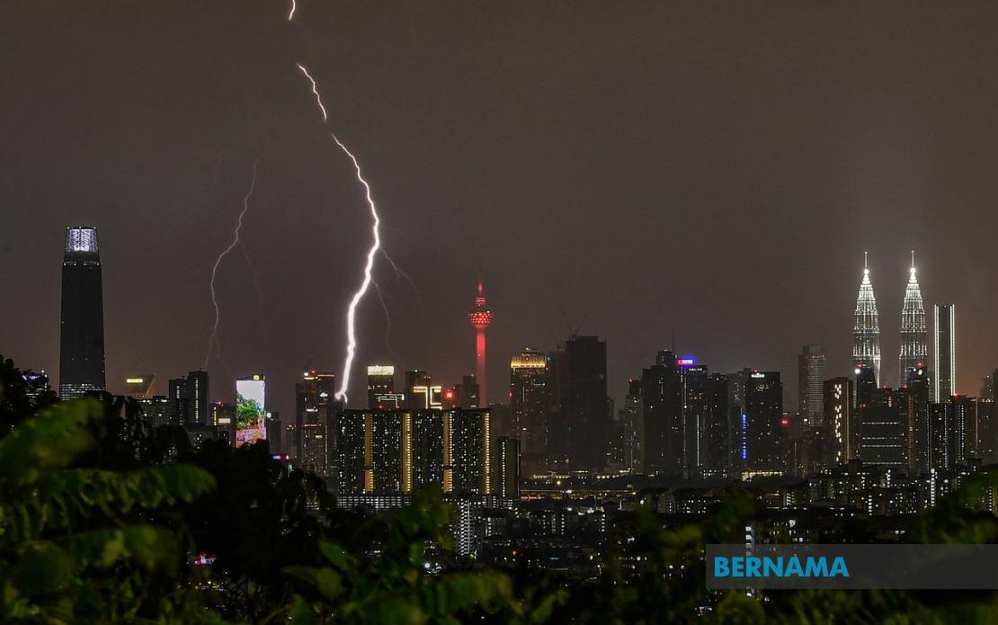
Malaysia's weather monitoring authority issued a significant warning on Thursday afternoon as severe thunderstorms threatened to sweep across the Klang Valley and multiple states across the peninsula. The Malaysian Meteorological Department released the alert at 2 pm, cautioning residents to prepare for hazardous conditions including heavy downpours and gusty winds that could persist until evening. The warning encompasses the Federal Territory of Kuala Lumpur alongside two complete states and portions of six others, affecting millions of residents and commuters across the most densely populated corridor in the country.
The two states experiencing warnings across their entire territories are Melaka and Penang, indicating uniformly threatening atmospheric conditions expected to develop throughout these regions. In Penang, particularly, residents should anticipate disruptions to evening activities as the storm system moves through. Melaka, situated further south in the peninsula, is similarly braced for the incoming weather pattern that forecasters expect to intensify during the afternoon peak period.
Kedah faces significant exposure, with five of its districts falling within the warning zone. The affected areas—Kuala Muda, Sik, Baling, Kulim and Bandar Baharu—span both the central and northern portions of the state, suggesting the weather system has regional rather than localized impact. These regions include major population centers and agricultural areas, where heavy rainfall could potentially trigger flooding and disruption to activities.
Perak's extensive warning area reflects the state's geographical position along the main peninsular landmass. Five districts are included: Kerian, Larut, Matang and Selama, Hulu Perak, Kuala Kangsar, Kinta, Kampar, Batang Padang and Muallim. This wide coverage indicates the storm system poses significant risk across Perak's populated western coast and inland districts alike, with implications for both urban centers and rural communities dependent on stable weather.
Pahang's exposure highlights how the system extends into the east coast region. Six districts face the warning: Cameron Highlands, Lipis, Raub, Bentong, Pekan and Rompin. The inclusion of Cameron Highlands is particularly notable given the highland terrain's vulnerability to heavy rainfall and associated flash flood risks. The warning's extension to coastal Pekan and southern Rompin indicates the storm system possesses significant geographical reach across diverse topographies.
The Klang Valley region faces particularly acute risk given its dense urban infrastructure and concentrated population. Seven districts across Selangor fall within the warning parameters: Sabak Bernam, Kuala Selangor, Hulu Selangor, Klang, Gombak, Petaling and Hulu Langat. These districts encompass Greater Kuala Lumpur's sprawling suburban areas, industrial zones, and residential developments. Such extensive coverage in Selangor, combined with the Kuala Lumpur alert, suggests commuters and city dwellers should prepare for potential traffic disruptions and delays during rush hour as the storms develop.
Johor and Negeri Sembilan round out the affected regions. Negeri Sembilan faces conditions in Jelebu, while Johor's southern districts—Tangkak, Segamat, Muar, Batu Pahat, Kluang and Mersing—experience the warning coverage. This extended reach down the peninsula suggests the weather system maintains considerable geographical scope and intensity across a north-south axis, potentially affecting supply chains and transportation corridors that connect multiple states.
The thunderstorm warning comes with particular relevance for Malaysian commuters during evening peak hours. Heavy rain combined with strong winds could reduce visibility on major expressways, potentially triggering accidents and congestion across the peninsula's primary highway network. Public transportation systems may experience delays, while outdoor activities and events scheduled for the late afternoon should be reconsidered given safety concerns associated with lightning strikes and wind hazards.
MetMalaysia's advisory to remain alert and monitor continuous updates reflects the dynamic nature of tropical weather systems. Conditions can change rapidly, with storm intensity fluctuating or new cells developing within the broader warning zone. Residents are encouraged to check official weather channels regularly rather than relying on initial predictions, as meteorologists continue tracking the system's development and movement patterns throughout the afternoon.
The practical implications for Malaysian businesses and households are substantial. Companies should consider allowing flexible working arrangements or early departures to help employees reach home safely before conditions deteriorate. Agricultural operations should secure loose materials and temporary structures, while construction sites should implement weather-related safety protocols. Households ought to clear drainage systems, secure outdoor items, and maintain emergency supplies in case localized flooding affects neighborhoods.
For travelers crossing affected states, journey planning becomes critical. Those heading north through Perak or traveling to Penang and Kedah should anticipate delays and potentially hazardous driving conditions. The warning's afternoon timing means evening travel could prove particularly challenging as darkness combines with reduced visibility from rain. Alternative routes or postponed travel should be considered where flexibility permits.
The regional nature of this warning demonstrates how tropical weather systems operating across Southeast Asia can simultaneously impact multiple jurisdictions with serious consequences. Malaysia's equatorial and subtropical location renders such events relatively common during monsoon seasons, yet each occurrence demands public preparedness and responsive weather monitoring. MetMalaysia's timely alert provides residents with crucial hours to prepare, adjust plans, and implement safety measures before conditions peak during late afternoon hours.

