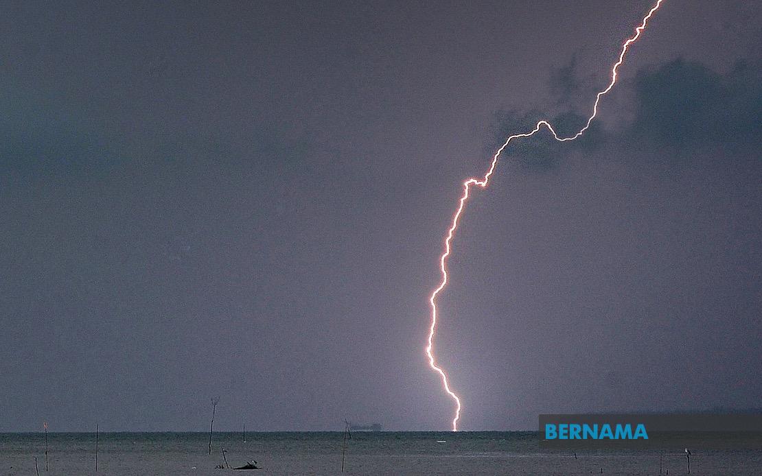
The Malaysian Meteorological Department has cautioned residents across a significant swathe of the country to prepare for deteriorating weather conditions, with thunderstorms, intense rainfall and gusty winds forecast to affect numerous districts until 5 pm today. The warning, issued on July 22, covers populated and semi-rural areas spanning from the northern peninsula down through the east coast and into Sabah, reflecting a weather system of considerable geographic extent.
In Kedah, the district of Baling faces the brunt of the impending weather disruption. Across the border in Perak, a particularly large stretch of territory is in the line of the system, encompassing the major industrial and residential zones of Manjung and Kinta, alongside the districts of Perak Tengah, Kampar, Bagan Datuk, Hilir Perak, Batang Padang and Muallim. The concentration of affected areas in Perak underscores how the weather pattern appears to have organised itself along the western spine of the peninsula.
Terengganu residents in Setiu, Kuala Nerus, Hulu Terengganu, Kuala Terengganu, Marang, Dungun and Kemaman should expect similar severe conditions. The east coast state, known for its vulnerability to weather systems during the monsoon season, has been identified as a particular risk zone. The warning extends down the peninsula to Pahang, where the highland district of Tanah Tinggi Cameron, along with Lipis, Jerantut and Kuantan, face the incoming storms. Cameron Highlands tourists and residents should exercise heightened caution given the elevated terrain's propensity for flash flooding and landslides during heavy precipitation events.
Selangor, the country's most densely populated state surrounding the capital, has also been placed under alert. The districts of Sabak Bernam, Kuala Selangor, Hulu Selangor and Gombak will experience the turbulent conditions, meaning substantial portions of the Klang Valley and its surrounding suburban sprawl may face disruptions to daily activities and transport networks during the afternoon peak hours. This timing increases the potential for congestion and weather-related incidents on major highways serving the federal territories and commuter belts.
Johor's southern tier likewise faces the weather system's reach, with six districts designated as high-risk zones: Kluang, Mersing, Pontian, Kulai, Kota Tinggi and Johor Bahru. The inclusion of Johor Bahru, the state's largest urban centre and a major commercial hub, indicates that significant economic activity and movement of goods could be hampered during the warning period. Mersing and Kota Tinggi, coastal and near-coastal areas respectively, may face additional complications from wind-driven sea conditions.
Sabah's east Malaysian territory also falls within the meteorological department's warning zone. The Interior division communities in Kuala Penyu, Beaufort and Tambunan, alongside the West Coast region, have been flagged for severe weather. Additionally, Beluran in Sandakan and the northern district of Kudat are included in the alert. For Sabah residents, particularly those in rural and semi-isolated areas, such weather events can rapidly degrade road conditions and disrupt supply chains, necessitating advance preparation.
The meteorological department's alert mechanism serves as an early warning system designed to give the public, emergency services and relevant agencies sufficient notice to implement precautionary measures. The 5 pm deadline suggests that the system is anticipated to move through or weaken by early evening, though localized impacts may persist in some areas. Residents in affected zones are typically advised to secure loose outdoor items, avoid unnecessary travel, refrain from crossing swollen waterways, and remain alert for weather updates from official sources.
The geographic breadth of this warning—spanning from Kedah in the north to Sabah in the east—indicates a weather pattern of significant meteorological importance. Such expansive systems are characteristic of the southwest monsoon season, during which the peninsula and northern Sabah experience increased instability and convective activity. The warning's specific time window reflects MetMalaysia's capacity to narrow forecasts to actionable timeframes, allowing businesses, schools and transport operators to adjust schedules with reasonable confidence.
For Malaysian policymakers and disaster management authorities, widespread weather alerts like this serve as periodic reminders of the country's exposure to tropical weather hazards. The coordination required across multiple state governments and federal agencies to respond effectively to such events tests the resilience of existing warning and response infrastructure. As urban development continues to expand across many of these affected districts—particularly in Selangor, Johor Bahru and Perak's industrial corridors—understanding how thunderstorm events interact with increasingly built-up landscapes becomes an ongoing planning consideration.
Communities in the affected areas are urged to monitor official MetMalaysia updates and exercise appropriate caution during the warning period, particularly those in flood-prone localities and mountainous regions where rapid water accumulation poses the greatest hazard.

